
How to Get Around Mexico City: A Practical Guide to Scale and Neighbourhoods
Mexico City does not unfold like a compact European capital.
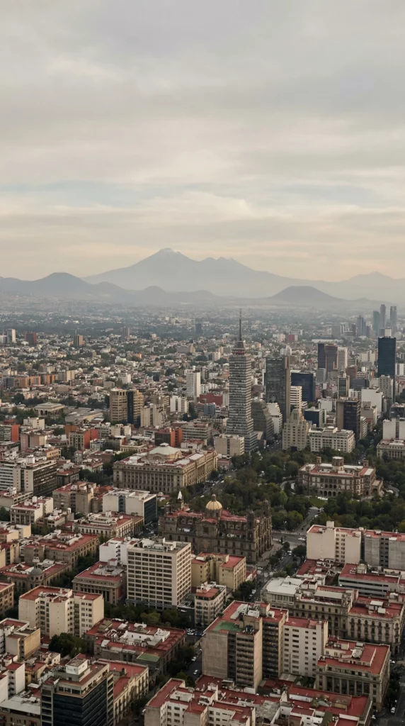
Mexico City is expansive, layered, and physically elevated. Distances that appear manageable on a map can take far longer in practice. Traffic patterns shift. Neighbourhood identities are strong. Altitude affects energy more than many visitors expect.
Understanding how to get around Mexico City begins with accepting its scale.
Think in Neighbourhood Clusters
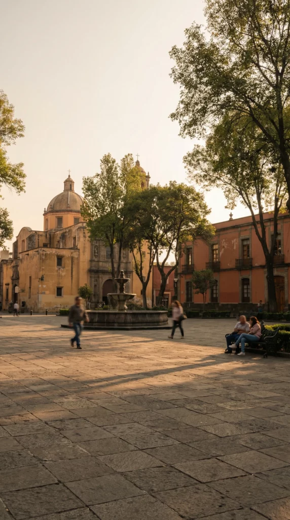
Mexico City is best experienced in sections rather than as a single, continuous centre.
Visitors often move between:
- Centro Histórico
- Roma and Condesa
- Coyoacán
- Chapultepec
Each area has a distinct rhythm. Attempting to cross the city multiple times in one day rarely leads to depth.
Instead, choose a neighbourhood cluster and stay within it. Explore on foot. Sit in its cafés. Notice the architecture and street life.
Scale requires strategy.
Respect the Altitude
Mexico City sits at over 2,200 metres above sea level.
Even if you feel fine initially, fatigue can accumulate quietly.
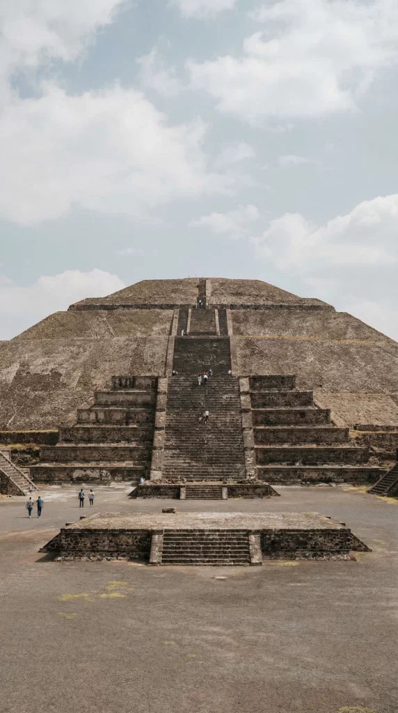
On my own visit, I climbed the Pyramid of the Moon without issue. By the time I reached the base of the Pyramid of the Sun, however, the combination of altitude and heat made it clear that pushing further would be unwise.
I chose not to climb.
Standing at the base and looking upward was enough.
Mexico City rewards awareness of limits. Not every site needs to be physically conquered to be meaningful.
Plan lighter first days. Hydrate. Pace climbs and long walks carefully.
Altitude is subtle but real.
Use Transport Strategically
Getting around Mexico City requires a balanced approach.
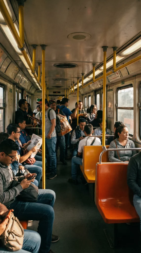
Metro
The Metro system is extensive and inexpensive. It connects major areas efficiently, though it can be crowded during peak times.
For longer distances between neighbourhood clusters, it is often the fastest option.
Uber
Uber is widely used and practical. For areas less directly connected by Metro or when energy is low, it provides a comfortable alternative.
Traffic can be heavy, particularly at peak hours, so build extra time into journeys.
Walking
Walking works beautifully within neighbourhoods such as Roma, Condesa, and Coyoacán. Streets are lively, parks are integrated into daily life, and details emerge slowly.
Walking across the entire city, however, is unrealistic. Distances accumulate quickly.
Transport should support your day — not dominate it.

Choose Your Base Carefully
In a city of this scale, accommodation location has an outsized impact.
Staying in Roma or Condesa allows easy walking, tree-lined streets, and access to cafés and parks. Centro Histórico places you close to major historic landmarks but can feel intense and crowded.
Coyoacán offers a slower rhythm but sits further from central clusters.
Choose a base that aligns with the pace you want. Crossing the city daily is rarely sustainable.
Neighbourhood identity shapes experience here more than almost anywhere.
Safety Without Paralysis
Mexico City often appears in headlines more than in everyday narratives.
Practical awareness matters. So does proportion.
Move confidently. Stay in well-trafficked areas. Use established transport. Avoid deserted streets late at night.
But avoid letting hypothetical fears dictate every decision.
If you allow yourself to be paralysed by what might happen, you limit what can happen.
Common sense and instinct are powerful tools. Pay attention to how an area feels. Adjust accordingly.
Measured awareness allows engagement. Constant fear prevents it.
Mexico City Rewards Measured Movement
Mexico City does not yield to rushed itineraries.
It requires acceptance of distance, altitude, and rhythm. It asks you to move within neighbourhoods rather than across the entire map in a single day.
Understanding how to get around Mexico City is ultimately about respecting scale.
Cluster your days. Use transport strategically. Hydrate. Rest. Notice.
You do not need to conquer the city.
You need to move through it well.
TLDR
- Think in neighbourhood clusters rather than crossing the city daily.
- Respect the altitude and pace climbs carefully.
- Use Metro for long distances and Uber when practical.
- Walk within neighbourhoods, not across the entire city.
- Practice awareness without paralysis.
Mexico City reveals itself through rhythm, not speed.
FAQ
Is Mexico City easy to get around?
Yes, but it requires planning. The Metro is extensive, and Uber is widely available, but distances are significant.
Is the altitude noticeable in Mexico City?
For many visitors, yes. Fatigue and light-headedness can occur, particularly during physical activity or in the first days.
Should I use Uber or the Metro in Mexico City?
Both are useful. The Metro is efficient for major routes, while Uber can be more comfortable for longer or less direct journeys.
Which neighbourhood is best to stay in?
Roma and Condesa offer balance and walkability. Centro Histórico is convenient but busy. Coyoacán provides a quieter atmosphere.
Is Mexico City safe for visitors?
Most central neighbourhoods frequented by visitors are manageable with common-sense precautions. Awareness and confidence go further than alarmism.